
…when we’re parked at this Starbucks it will be 6:00 in the morning – an hour and fifteen minutes before sunrise and too dark to take a picture! But this is where we’ll be, our last stop in Richmond before we hit the road. We plan to be on I-64 West with the cruise control on by 6:30 AM. So when the sun rises around 7:15, we’ll be almost to Charlottesville. By lunchtime a week from today we’ll probably be almost to Charleston, WV and stopping for a bite to eat and the first of many, many tanks of gas. Hopefully by dinnertime on that day (Thursday, February 2) we’ll be pretty far west of here and finding a good place to spend the night, and hopefully it will have an internet connection so I can update this blog!
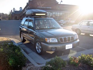
Packing is going smoothly, and I’ve got the car washed and the roof rack up. The car looks so shiny and beautiful in these pictures – I can’t imagine what it will look like when we return in March!
Just FYI, some people had inquired about our general route. Due to uncertainties about weather and road conditions and so forth it’s impossible to tell where we’ll be sleeping each night. But our approximate route will be:
Richmond, VA (N37º x W77º)
St. Louis, MO (N38º x W90º)
Denver, CO (N39º x W105º)
Cheyenne, WY (N41º x W105º)
Salt Lake City, UT (N41º x W112º)
Boise, ID (N44º x W116º)
Portland, OR (N45º x W122º)
Seattle, WA (N47º x W122º)
Vancouver, BC (N49º x W123º)
Whitehorse, YT (N61º x W135º)
According to my Trip Tiks from AAA, that route will take 4,761.9 miles. Of course, that doesn’t take into account stops for gas, food, coffee, restrooms, hotels, etc. I’ll be surprised if it’s less than 5,000 miles to get out there. I’ll have a lot of what my brother Shane referred to as “Zen time,” as in driving across Kansas and seeing a sign that says “State line, 423 miles” and there’s nothing but grass and fence and sky (hopefully not filled with snow clouds) as far as the eye can see.
I’ll post my location every night I’m able. I’ll give the address or whatever for “normal” people, and for you geeks (that would include all males in my immediate family, and a few others) I’ll give my location by latitude and longitude, as in the list above. If you don’t understand that but you’re interested, there will be two numbers: an “N” with a number after it and a “W” with a number after it. “N” is northern latitude, or degrees north of the equator. As the number gets larger, we’re going farther north. “W” is western longitude, or degrees west of Greenwich (London) England. As the number gets larger, we’re going farther west. The numbers following the degrees are just smaller and smaller “slices” of a degree. Here are some approximate examples of places, just to help you get oriented:
The Equator: 0º
The North Pole: N90º
My house - Richmond, VA: N37º 36’ 09.8” x W77º 33’ 16.0”
Key West: N24º x W81º
Atlanta: N33º x W84º
Chicago: N41º x W87º
Seattle: N47º x W122º
Vancouver: N49º x W123º
Whitehorse: N60º x W135º
On the chart of our route that appear near the top, notice the number after “N” grows larger as we go North and the number after “W” grows larger as go West.
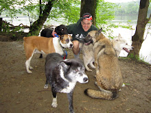
Also, if you’re not from Richmond, or if you are from Richmond and you didn’t see yesterday’s Richmond Times Dispatch, Mark Holmberg wrote a very nice article in the Metro section about the dogs and me and this trip (among other things). You can read the complete text of the article if you click the link that says “VIEW MY COMPLETE PROFILE” near the upper right hand corner of this blog. Once there, look to the left and under our picture (that picture was taken by Shane up at Mom and Dad’s house around Christmas) there is a space that says “Contact.” Below that, click on the link that says “My Web Page.” You’ll see a couple of pictures of Ivory and Nicky and a picture of my house below them. Just go down a little bit farther and you’ll see links to three nice articles that Mark has written in the past. The one from yesterday’s paper is up there now too.
I may be updating a little more frequently between now and the start of the trip – no promises, though. Until then, have a great day,
Jay


